
Walk a Streamwood Street
A useful Streamwood street directory is built parcel by parcel. Ownership is easier to document than occupancy. The county map and assessor connect an address to land, while the deed index records transfers. A tax mailing name is only a clue because it may belong to an agent, lender, relative, or former owner. A voter search is for an individual checking registration, not for exporting a street roster. Historical directories may identify occupants, but only when a volume truly covers the suburb and year in question.
- Validate the delivery form with the USPS lookup, including any apartment or unit. Keep both the entered form and the returned form.
- Enter the address in CookViewer. Capture the parcel identification number, or PIN, and use the map to select the full visible street segment.
- Open the Cook County Assessor and Property Tax Portal records. Keep the property location separate from the tax mailing block.
- Follow the PIN into Cook County Clerk Recordings. Read deeds as title events, not as proof of a move-in date.
- For older occupant clues, check only scope-confirmed criss-cross sources at Poplar Creek, Newberry, or the Chicago History Museum.
The result is a dated worksheet, not a live roll of everyone present. One postal address may contain several condo PINs, while one large PIN may include more than one numbered place. Record each PIN on its own row.
Map Streamwood Streets in CookViewer
CookViewer is the best official bridge from a road to its parcels. It accepts an address, intersection, and several PIN formats. After opening one property, rectangle and polygon tools can select both sides of a block. Nearby Search adds parcels within a chosen radius. The export control can save selected property data as CSV or Excel, which is useful when a curved road, cul-de-sac, drainage lot, or common area breaks a neat address sequence.
| CookViewer control | Input | Required | Street result |
|---|---|---|---|
| Search mode | All, Parcel, PIN, Parcel Address Locator, Address Locator | Yes | Chooses how the query is read |
| Search text | PIN, address, or intersection | Yes | Finds the first map point |
| Select Tool | Rectangle or polygon | No | Selects many parcels on a segment |
| Nearby Search | Selected parcel and radius | No | Finds parcels around the starting point |
| Export | Selected property data | No | Creates a block worksheet |
The detail panel adds municipality, township, zoning, tax and service districts, plus links to the Assessor, Clerk, and Tax Portal. It is current GIS, not a historic owner file. The application displayed a May 28, 2026 release along with two earlier release notices, so save a capture date whenever map behavior matters.
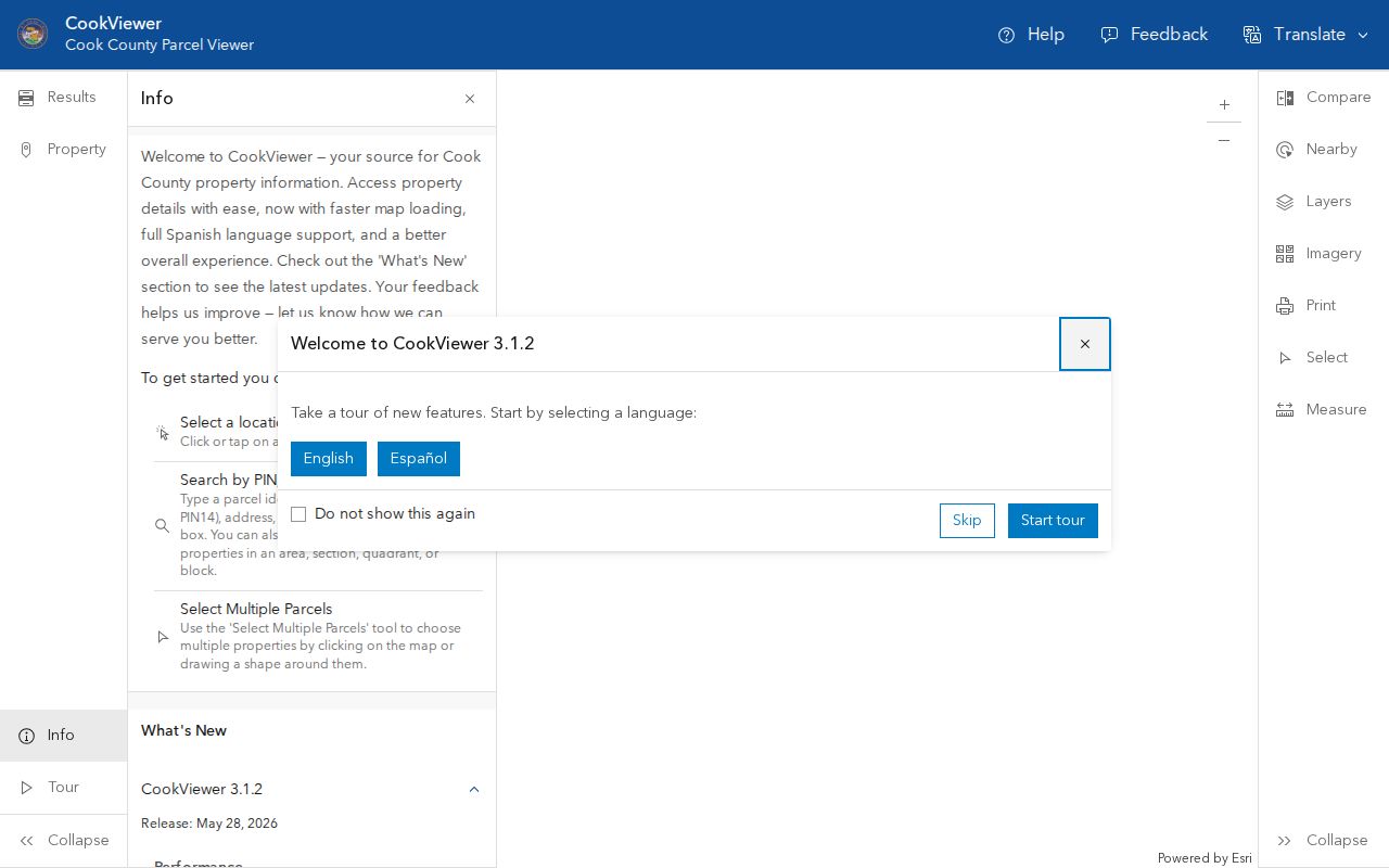
The map view shows why parcel edges, rather than house-number order alone, define the street research set.
Search Streamwood Assessor Fields
The Cook County Assessor address search expects a house number and street name without the suffix. Direction and unit are separate controls, while city and CAPTCHA complete the search. Its neighborhood mode uses township, neighborhood, and property class. The basic form inspected for the research did not expose a verified owner-name field, so do not promise a direct owner search when the live control is not present.
| Field | Entry type | Use in a street directory |
|---|---|---|
| House Number | Required text | Starts an address search |
| Direction | Optional dropdown | Separates directional variants |
| Unit Number | Optional text | Distinguishes condo or apartment results |
| Street Name | Required text | Enter the name without Ave, St, or Pl |
| City | Portal-marked text | Use Streamwood when the mailing city fits |
| Neighborhood mode | Dropdowns | Browses township, neighborhood, and class |
An assessor card can show the PIN, property class, square footage, neighborhood, estimated market value, assessed values, characteristics, exemptions, appeals, and certificates of error. Those facts describe a taxable parcel. Even a homeowner exemption is tax evidence, not proof of every person living there.
Separate Three Streamwood Addresses
Cook County uses several address concepts, and mixing them creates false matches. The Assessor's property location is a map locator. The Property Tax Portal displays that property address apart from the mailing address used for tax correspondence. A recorded instrument may instead describe the land by subdivision, lot, block, condo unit, easement, or metes and bounds.
- Parcel
- A mapped unit of land tied to a Cook County PIN.
- Situs address
- The physical property location used for assessment or mapping.
- Plat
- A recorded map that defines lots, blocks, easements, or subdivision lines.
- Criss-cross directory
- A historical directory arranged by street and house number rather than only by surname.
The Cook County Property Tax Portal requires house number, street, and city, with unit and ZIP optional. It reports a separate mailing block, five-year billing history, exemptions, recent document summaries, and tax-sale status. Treat any name there as correspondence evidence until another record confirms its role.
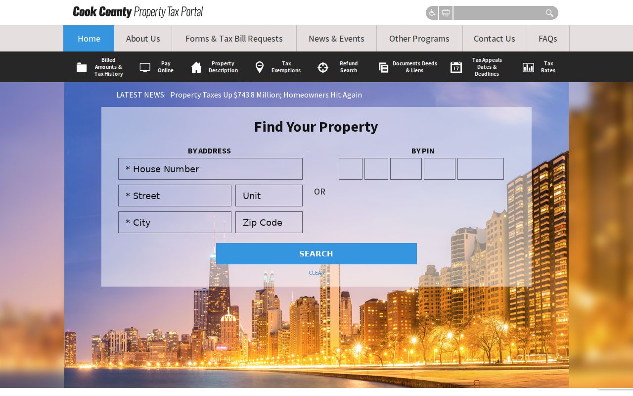
The distinct search fields help preserve unit and ZIP details without confusing delivery data with legal title.
Streamwood Records Keyed by Address
No single office keeps the whole Streamwood street directory. Each custodian answers a different question, and the access route changes when a portal has no historic depth. The PIN links most property sources, while an exact address and date range make a Village request much more useful.
| Address source | Custodian | What it can establish | Access route |
|---|---|---|---|
| Property card | Cook County Assessor | PIN, class, values, traits, exemptions | Free current portal |
| Parcel GIS | Cook County GIS | Boundaries, zoning, districts, nearby parcels | Free map and export |
| Tax record | County Tax Portal | Property and mailing blocks, tax history | Free address or PIN search |
| Deeds and liens | Cook County Clerk Recordings | Parties, type, date, document number, legal description | Online from 1985; older books or office research |
| Permits and code files | Streamwood Community Development | Applications, inspections, occupancy, complaints, zoning | CSS for current work; targeted FOIA for files |
| Plats | County Clerk and Village | Lots, blocks, easements, subdivision approvals | Recorded copy or Village file request |
Illinois voter systems do not add a lawful by-street list. The public lookup is for individual registration and polling information, while full-file access is restricted and sensitive fields are redacted. That boundary matters when the goal is to identify residents rather than land.
Follow Streamwood Deeds by PIN
Once a parcel is known, use the Cook County Clerk Recordings System. Search by PIN first. A deed is a conveyance, a transfer of title. A mortgage records financing, a release can show satisfaction of a recorded claim, a lien is an encumbrance, and a plat defines land divisions. These document types should not be treated as interchangeable signs of ownership.
For each parcel, record the latest deed's document number, recording date, grantor, and grantee. The grantor transfers an interest and the grantee receives it. Then search the grantor as an earlier grantee, keeping the legal description in view because PINs can split or consolidate. Online retrieval is documented from 1985 forward. Earlier work shifts to tract books, old record books, the downtown records facility, or a title researcher. Confirm current access details with the Recording Help Desk before traveling.
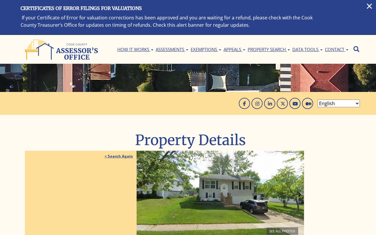
The sample parcel detail demonstrates how a PIN anchors property facts before a researcher opens the separate recordings index.
Note: A deed date records a legal event, while a directory year, tax year, permit date, and move date answer different questions.
Request Streamwood Permit Files
Streamwood's Citizen Self Service portal supports current permit, contractor-registration, and business-license work. Historical files or records that do not appear in the portal call for a narrow request to the Village. Useful categories include building permits and plans, inspection reports, occupancy certificates, property-code complaints, stop-work orders, zoning applications, plats, and sign permits.
Name the department, exact address, and a defined date span. Ask whether responsive material will be supplied as a redacted copy, made available for inspection, or reported as absent. The Streamwood FOIA route accepts written requests through the Village Clerk. Ordinary requests generally receive a response within five business days, though the statute permits an extension in qualifying cases.
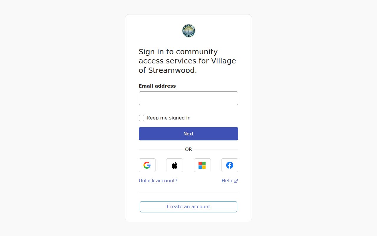
The portal is an entry point for current municipal activity, while the Clerk remains the fallback for existing address files.
Check Streamwood Address Districts
The Streamwood Community Portal accepts an address and unit, then returns school, park, library, elected-official, zoning, and bike-map context. CookViewer supplies another set of township, municipality, zoning, and tax-district layers. District borders cross mailing-city and Village lines, so a Streamwood postal label does not by itself prove Village jurisdiction.
Save the layer name and date with each result. If county and Village maps disagree, ask the body that owns the boundary instead of choosing one. This is especially important near Bartlett, Schaumburg, and Hanover Township edges. Streamwood's road references include Irving Park Road, Lake Street, Route 59, and Barrington Road, but none creates a simple townwide numbering rule.
Decode Older Streamwood Street Names
Before Streamwood incorporated, records may use Hanover Township or Hoosier Grove rather than the Village name. Farm-road references can include Bartlett, Schaumburg, and Oltendorf Roads. Later files may use route numbers for Irving Park Road, Lake Street, or Route 59. Search all supported forms, then compare the result with a dated plat, map, deed, or municipal file.
No official complete old-to-new street number list was located. That is a real research gap, not a reason to infer a renumbering date. When the present address fails, ask Community Development or Public Works for a plat, address history, road-opening record, or tightly scoped FOIA response. Historical address-to-occupant work belongs in a scope-confirmed regional volume; the Streamwood directory book page explains what Poplar Creek and regional archives actually hold.
Limits of Streamwood Street Lookups
A street directory cannot supply a complete, current household roll. Renters and family members may never appear in parcel or deed files. Driver records, utility accounts, delivery records, protected voter data, and Address Confidentiality Program locations are not general public sources. A mailing name does not prove occupancy, an exemption does not name every resident, and adjacency on a GIS map does not prove a social relationship.
Commercial address compilations can merge old and current facts, but they do not replace the official custodian. For family history, property curiosity, estate work, or scam checks, note the source date and verify the record that matters with Cook County or the Village.
Lawful use. Use Streamwood address records only for a lawful personal purpose. Never use a street search to stalk, harass, intimidate, or harm anyone.